Addressing the urban challenge
Breadth of the issue – How are the problem(s) that are being tackled by your initiative affecting citizens/local businesses or a significant component of the local wildlife?
A robust impact assessment framework entails careful reflection and planning of monitoring and evaluation processes which pertain to the design of NBS. By definition, NBS are multifunctional. NBS assessment is central to evaluating the strengths and weaknesses of specific interventions against strategic city goals. The ultimate goal is to gather long-term solid evidence about NBS performance in urban contexts with reference to our wide-ranging social groups and communities. In turn, this evidence can support smart policy decisions and adaptive co-management aspects of NBS stewardship once installed, as well as enhance sustainability, wellbeing, and resilience in cities. Evaluating effectiveness of NBS interventions is also useful in developing cost-effective policies which support our work in advocating for more investment, including taking advantage of broader funding streams. The dashboard development has provided colleagues with visualised data for the first time, which allows them to know what’s available and to ask the right questions prior to starting work on initiatives. It is, therefore, almost a first step to making sure monitoring and evaluation takes place, by allowing access to traditionally ‘technical’ streams (e.g. spatial mapping, statistics, graphs) to planners within councils. Monitoring and evaluation processes advance the arguments as to the benefits that NBS can deliver and improve the evidence-base and data availability within urban planning.
Depth of the issue – How seriously are the problems being tackled by your initiative impacting the life of the citizens/businesses/wildlife concerned?
The design and development of the Impact Assessment Framework within the Connecting Nature project involved a comprehensive review of the existing grey and scientific literature on impact assessment in NBS, as well as a co-creation process with three European cities (Genk, Glasgow and Poznan). The different steps of this process that sought to identify the gaps between the research and the needs of the cities are summarised in four phases that can be consulted in Deliverable 1.1 of the project (Dumitru et al., 2019). These phases were:
- Comprehensive scoping of NBS projects in Europe
- Identifying most innovative emerging experiments involving nature-based solutions across Europe and their transformative elements
- Reviewing scientific literature, consultations with experts outside Connecting Nature and Indicators co-creation activities with FRCs
- Co-creation workshops with Front-runner cities to identify the suitability of the framework to evaluate their NBS
All these phases contributed to creating a robust Impact Assessment Framework based on the scientific evidence existing to date.
The dashboard development was brought about as a result of the lack of data availability for urban planners and the recruitment of a spatial analyst who was able to take advantage of new technologies. The dashboard’s limitations are around the topic of analytics, as it does not automate the data analysis process. However, this was never the intention of the dashboard, which was primarily created as a data visualisation tool for planners to get accustomed to data and start thinking about the necessity of ‘evidence-based’ decision-making.
The power of plants and natural ecosystems to deliver benefits
How is the initiative shaped by scientific evidence of the potential for plants and natural ecosystems to deliver benefits?
The main outcomes of the project presented in the previous section (Impact Assessment Guidebook and Glasgow’s Dashboard) are on their own powerful dissemination tools since they can be consulted by urban planners, stakeholders or any citizen who is interested in undertaking NBS or tracking impact.
The ultimate goal is to help cities make evidence-based decisions that facilitate a policy process adapted to local needs. In addition, seeking to give the greatest possible impact to this research through dissemination actions, the Connecting Nature Impact Assessment Framework and the Glasgow Dashboard have been presented at international summits and conferences aimed at practitioners and scientists. Examples of this have been the Glasgow Innovation Summit or The Nature of Cities Festival. In addition, the outcomes presented have been transferred to the Natured-based Enterprises Community of Connecting Nature to highlight the opportunities that these institutions and Nature-based organizations allow.
The dashboard was designed as a simple visualisation tool that is publicly available and contains open-source data. Interactive graphical and spatial components are being used to support the user’s journey into identifying trends and visualising the data.
How has the city exploited the potential of plants and associated ecosystems to deliver more than one benefit?
The Open Space Strategy and its role as the City’s exemplar within H2020 Connecting Nature has allowed the City to promote a Place Based Approach with Nature Based Solutions frame. This allows the City to focus on embedding Nature-based Solutions (“NBS”) into policy. NBS are intended to provide benefits not only to the environment, but also to the economy, people’s health and wellbeing, along with increasing social cohesion. The City is building a baseline of Glasgow-wide socio-economic, health-related and environmental data that it can use to track progress on NBS projects, but also the Open Space Strategy’s ability to promote them and improve citizen’s overall condition through open spaces. This data is visualised within an interactive dashboard powered by GIS. The dashboard does not allow for any direct outputs as it simply presents data in a spatial and graphical way. However, as the data pool gets fuller, the City intends to run statistical and spatial analyses that will provide it with relationships and insights into trends that it can then visualise through web apps for both Council and the public’s use. These analyses will allow the City to cite the best locations for different Nature Based Solutions; make decisions about retention; re-designing or making redundant open spaces, while also forming the basis for the development of NBS monitoring and evaluation plans. The methodology used to create the dashboard is transferable to other Councils and connects into work that the Scottish Government are exploring through their Digital Planning workstream.
Innovative and Collaborative Solution
How does the initiative show evidence of feasibility, including on-going financial and logistical support?
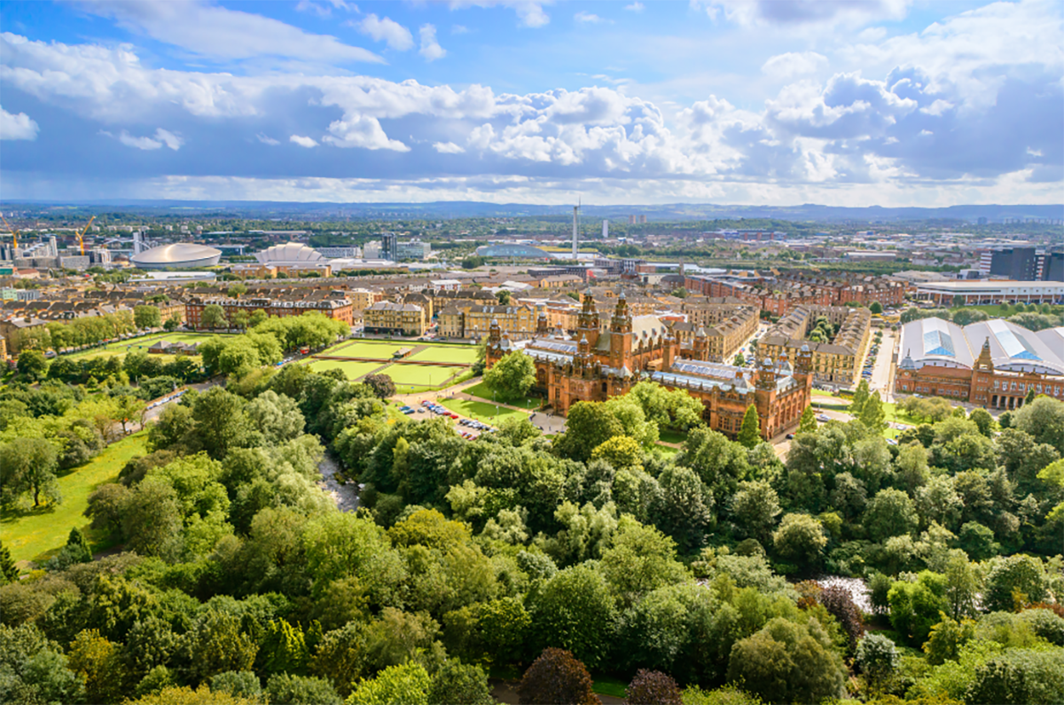
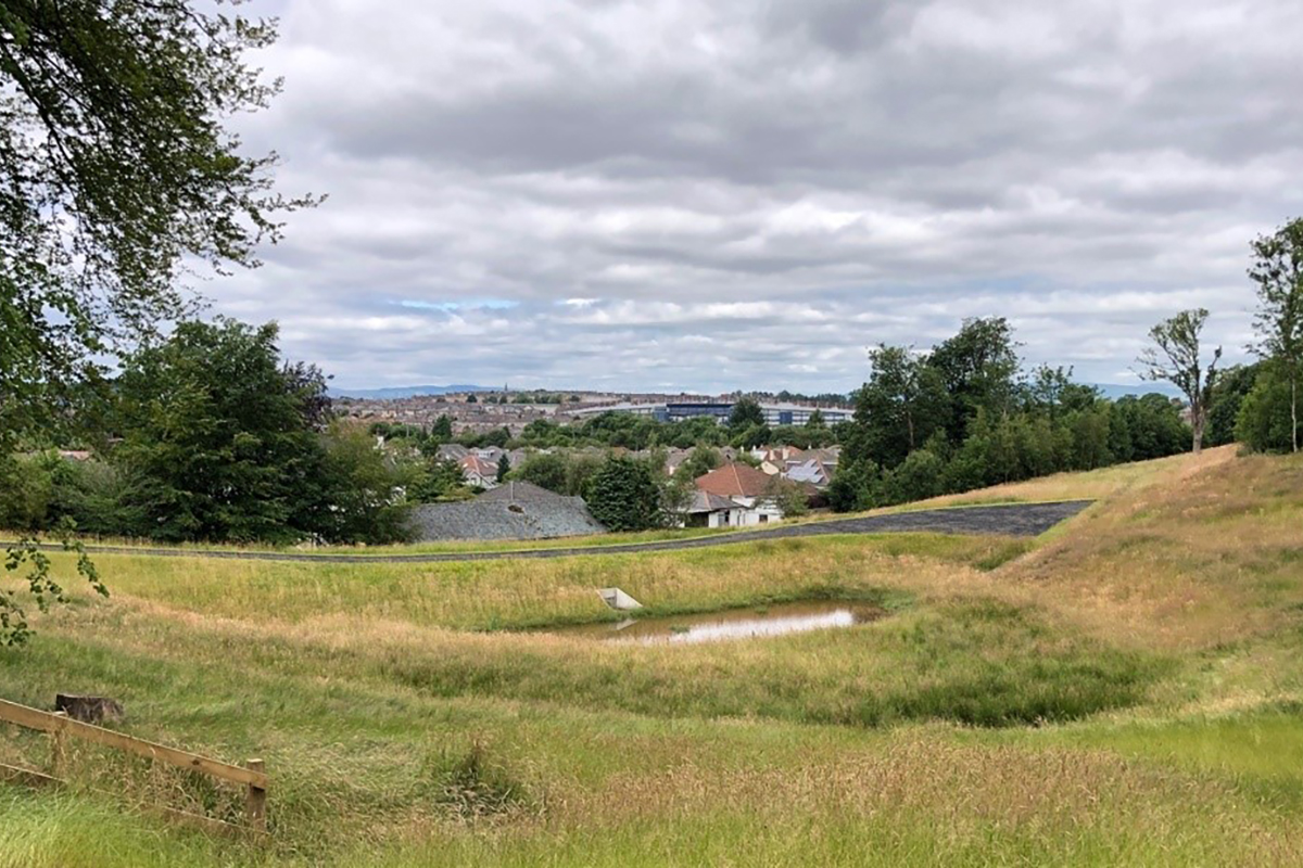
Data suggests that over 60% of the Glasgow population live within 500 metres of vacant and derelict land, which can have a negative impact on their collective mental health and wellbeing. Improving the Open Spaces and the environment that a community live within, can provide an opportunity to create an economic uplift; have a positive impact on the community’s health & wellbeing; create social cohesion and by default have a positive benefit on the biodiversity / ecosystem of the area. At the very least it would stabilise and improve biodiversity. Delivering nature-based solutions to enhance and increase open space in Glasgow can deliver multiple benefits for society, the economy and the environment. In this way, open spaces can offer opportunities for creating places for strong community cohesion, ecosystem services, healthy life, and access to jobs, education and culture, while responding to climate change including heavy rainfalls, heat waves and floods. For example, the Clyde is a tidal river: that means open spaces around it need to be designed in a multifunctional way. It’s possible to create an open space that is used as a football pitch capturing flood runoff during periods of intense rainfall. Experience has shown that efforts to address the city’s physical legacy and improve the environment have been successful where they have sought to address, not only appearance and context, but also anticipate the full range of benefits and opportunities that new development can generate in how people interact with and benefit from their environment.
In what ways is the initiative innovative?
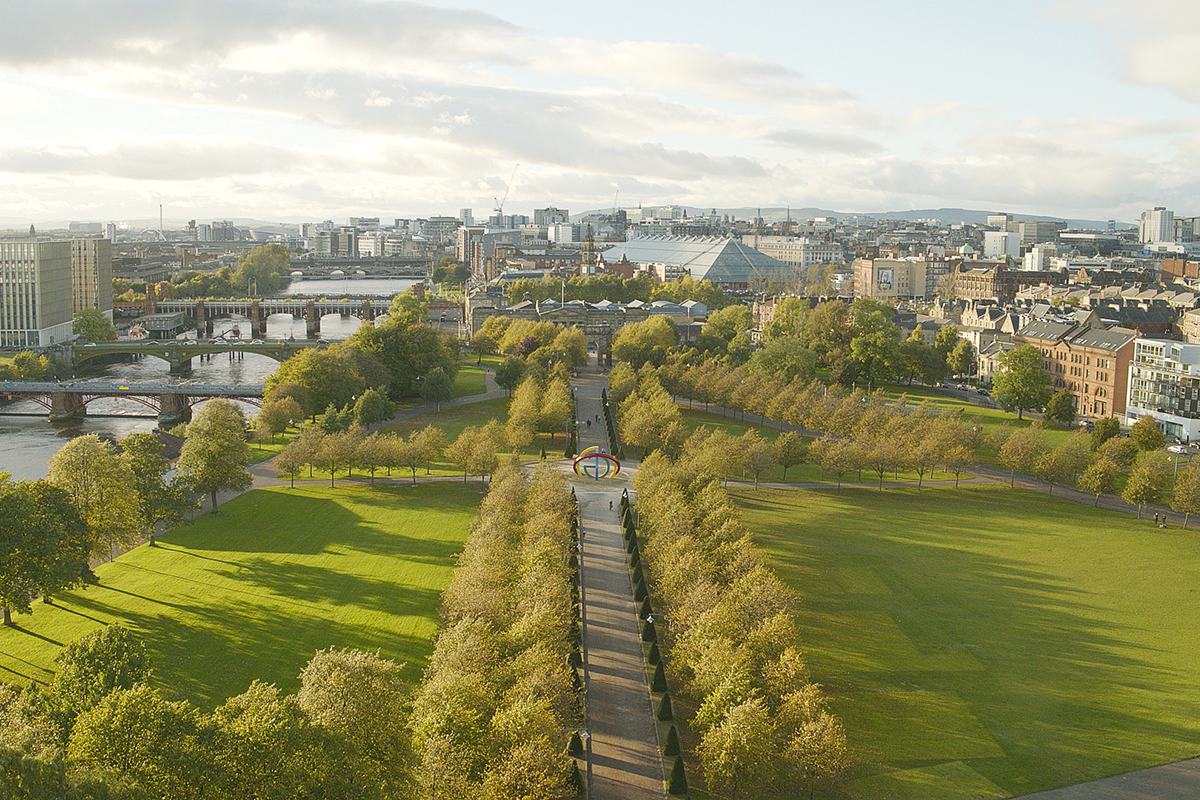
They allow individuals to interact with the natural environment and provide habitats for wildlife. They can also be important in defining the character and identity of settlements. Connecting them in a green network can provide enhanced benefits for people, the environment and biodiversity. Glasgow’s approach to developing scaled-up nature-based solutions is underpinned by its Open Space Strategy. Based on a wealth of data and spatial analysis, the Open Space Strategy sets out an approach to coordinate the various open space responsibilities to ensure well-managed, well located and well-connected open spaces that operate as part of a wider green network, helping to deliver:
- Greater awareness of the value of open space and of individual open spaces throughout Glasgow, informing their protection and management;
- A strategic rationale for the future use and management of the city’s open spaces, providing guidance on priorities for investment in open space, opportunities for using other open spaces less intensively; and an informed basis on which to make decisions about open space disposal, where an open space may be of little value;
- A basis for closer partnerships with other organisations that have an interest – e.g. with the NHS in how open spaces improve health;
- A framework for cross – departmental engagement and the co-ordination of spending plans to secure best value;
- A stronger basis for securing additional funding to help maximise open space benefits by promoting the value.
How is the initiative supported by collaborative working across disciplines and sectors?
As a statutory planning document, there is a clear aim to ensure consistency between the Open Space strategy (OSS), Development Plan and associated Supplementary Guidance. The strategy provides a place-based approach with a focus on Nature Based Solutions and has been developed by the Planners to ensure that it fits within the policy framework. The OSS has identified the key functions which the Council expects its open spaces to help deliver, including climate adaption, recreation and biodiversity. This enhanced understanding is helping inform a new approach to the protection of open space, providing for consideration to be given to the range of potential functions that an open space can provide in determining whether it can be developed. This approach will be embedded in the supplementary guidance, and will, in time, be informed directly by the enhanced understanding of the potential value of individual open spaces that will be provided by the OSS Delivery Plan. This holistic approach to open space will simplify, streamline and align decision making on planning matters with operational decisions on investment, maintenance and management, helping deliver better the better places envisaged in the City Development Plan.
How does the initiative demonstrate evidence of community support?
As a statutory planning document, there is a clear aim to ensure consistency between the Open Space strategy (OSS), Development Plan and associated Supplementary Guidance. The strategy provides a place-based approach with a focus on Nature Based Solutions and has been developed by the Planners to ensure that it fits within the policy framework. The OSS has identified the key functions which the Council expects its open spaces to help deliver, including climate adaption, recreation and biodiversity. This enhanced understanding is helping inform a new approach to the protection of open space, providing for consideration to be given to the range of potential functions that an open space can provide in determining whether it can be developed. This approach will be embedded in the supplementary guidance, and will, in time, be informed directly by the enhanced understanding of the potential value of individual open spaces that will be provided by the OSS Delivery Plan. This holistic approach to open space will simplify, streamline, and align decision making on planning matters with operational decisions on investment, maintenance and management, helping deliver better the better places envisaged in the City Development Plan.
Implementation, Impact and Replicability
How does the initiative demonstrate evidence of a track record of success against pursued objectives?
The Open Space Strategy and its role as the City’s exemplar within H2020 Connecting Nature has allowed the City to promote a Place Based Approach with Nature Based Solutions frame. This allows the City to focus on embedding Nature-based Solutions (“NBS”) into policy. NBS are intended to provide benefits not only to the environment, but also to the economy, people’s health and wellbeing, along with increasing social cohesion. The City is building a baseline of Glasgow-wide socio-economic, health-related and environmental data that it can use to track progress on NBS projects, but also the Open Space Strategy’s ability to promote them and improve citizen’s overall condition through open spaces. This data is visualised within an interactive dashboard powered by GIS. The dashboard does not allow for any direct outputs as it simply presents data in a spatial and graphical way. However, as the data pool gets fuller, the city intends to run statistical and spatial analyses that will provide it with relationships and insights into trends that it can then visualise through web apps for both Council and the public’s use. These analyses will allow the City to cite the best locations for different Nature Based Solutions; make decisions about retention; re-designing or making redundant open spaces, while also forming the basis for the development of NBS monitoring and evaluation plans. The methodology used to create the dashboard is transferable to other Councils and connects into work that the Scottish Government are exploring through their Digital Planning workstream.
How has the initiative had a ripple effect beyond the scope of the initiative itself, thereby demonstrating a change in the city’s and/or its partners’ way of working with plants?
Along with responding to the budgetary context, the OSS also highlights a need for the Council to more fully recognise and reflect the value of open space in decisions on budgets and in other decision making processes. One of the early deliverables from the development of the Open space Strategy is to develop protocols to give greater visibility to open space issues as a means of better informing decision-making across the Council. The Council is one of the biggest land owners and managers in the City. However the management of this land; the development of policy and the operational action are divided across a number of services within the Council. Open Space can be found within the assets that most of the Council services manage such as Public Parks; Sports Pitches; cycle routes; public realm; amenity land around council offices and in School grounds. Within the wider public sector large areas of publicly accessible open space are managed by Universities, the Health Board and the housing associations. The development of an OSS provides us with an opportunity to embed nature-based solutions and sustainable open space management as a key asset management tool for the public managed land and to provide a direction of travel for the land in private ownership.
How have other cities expressed interest in the initiative, or what potential does it have to interest other cities and be customised to their own circumstances?
The design and development of the Impact Assessment Framework within the Connecting Nature project involved a comprehensive review of the existing grey and scientific literature on impact assessment in NBS, as well as a co-creation process with three European cities (Genk, Glasgow and Poznan). The different steps of this process that sought to identify the gaps between the research and the needs of the cities are summarised in four phases that can be consulted in Deliverable 1.1 of the project (Dumitru et al., 2019). These phases were:
- Comprehensive scoping of NBS projects in Europe
- Identifying most innovative emerging experiments involving nature-based solutions across Europe and their transformative elements
- Reviewing scientific literature, consultations with experts outside Connecting Nature and Indicators co-creation activities with FRCs
- Co-creation workshops with Front-runner cities to identify the suitability of the framework to evaluate their NBS
All these phases contributed to creating a robust Impact Assessment Framework based on the scientific evidence existing to date.
The dashboard development was brought about as a result of the lack of data availability for urban planners and the recruitment of a spatial analyst who was able to take advantage of new technologies. The dashboard’s limitations are around the topic of analytics, as it does not automate the data analysis process. However, this was never the intention of the dashboard, which was primarily created as a data visualisation tool for planners to get accustomed to data and start thinking about the necessity of ‘evidence-based’ decision-making.
Sustainability and Resilience
What efforts have been made to reduce the carbon footprint of the initiative?
The main outcomes were two:
- the Impact Assessment Guidebook
- Glasgow’s Dashboard.
The guidebook presents the Connecting Nature process of developing robust monitoring and evaluation plans for NBS. Robust evaluation supports planners and decision-makers in building a solid evidence-base behind the impact of NBS and enhancing cost-effective and socially beneficial policy, building a foundation for scaled up delivery.
The Connecting Nature impact assessment framework has been co-produced by academic partners and representatives of three European cities in Connecting Nature, which are frontrunners in the implementation of NBS. The framework aims at contributing to the development of a European standard for NBS monitoring and evaluation. The guidebook can be consulted on Connecting Nature’s website https://connectingnature.eu/sites/default/files/images/inline/Impact%20Asessment%20Guidebook.pdf
The creation of the Impact assessment framework guidebook also fed directly into the development of the EU Evaluating the impact of Nature Based Solutions Guidebook for practitioners
The dashboard is being used by colleagues when looking at the availability of data and spatial trends and has prompted conversations about data gaps and creating wider access to geospatial software and improved digital planning practices within the Council. This has widened out the awareness of our technical capabilities and put more pressure to senior management to invest in data visualisation software for an improved planning service.
How have the anticipated impacts of climate change been considered?
The main outcomes of the project presented in the previous section (Impact Assessment Guidebook and Glasgow’s Dashboard) are on their own powerful dissemination tools since they can be consulted by urban planners, stakeholders or any citizen who is interested in undertaking NBS or tracking impact.
The ultimate goal is to help cities make evidence-based decisions that facilitate a policy process adapted to local needs. In addition, seeking to give the greatest possible impact to this research through dissemination actions, the Connecting Nature Impact Assessment Framework and the Glasgow Dashboard have been presented at international summits and conferences aimed at practitioners and scientists. Examples of this have been the Glasgow Innovation Summit or The Nature of Cities Festival. In addition, the outcomes presented have been transferred to the Natured-based Enterprises Community of Connecting Nature to highlight the opportunities that these institutions and Nature-based organizations allow.
The dashboard was designed as a simple visualisation tool that is publicly available and contains open source data. Interactive graphical and spatial components are being used to support the user’s journey into identifying trends and visualising the data.
What processes does the initiative include for it to be considerate in its use of soils and other natural resources?
The Open Space Strategy will help re-set the balance between our health, our infrastructure and our natural environment, protecting, enhancing and expanding Local Nature Reserves, and Sites of Importance for Nature Conservation and other biodiverse sites in the city, including peatland restoration and maintenance of existing sites. The recently published, “Food Growing Strategy” and ‘Glasgow City Food Plan’ will help address some of these challenges. The Food Growing Strategy will complement the review of the Stalled Spaces programme and the Open Space Strategy Delivery Plan. Park Power (in partnership with Green Space Scotland) – this project is currently considering how the city can assess opportunities to use our green and open space for heat and energy generation. This would focus on local generation using low carbon technologies such as ground and surface water source heat pumps. Protecting and improving Glasgow’s natural environment is a major part of mitigating and adapting to the impacts of climate change. To help achieve this, the best opportunities for greening and rewilding, including tree planting and the effective use of Vacant and Derelict Land sites, as recommended by the Ecological Emergency Plan, will be implemented via the Open Space Strategy (OSS) Delivery Plan. The OSS Delivery plan will also to map out opportunities to enhance Glasgow’s active travel routes, through improved green network linkages.
Monitoring, Maintenance, and Management
How has the initiative been designed and implemented so that long-term needs for management and maintenance are reduced and can be met?
An Open Space Strategy (OSS) for the City will help address this changing context and the changing role of open space. This Strategy sets out an approach for considering the different ways in which the people, flora and fauna of Glasgow will need to make use of open space, now and in the future, if the City is to successfully meet the demands set out above. It marks the start of a process for establishing and meeting the City’s open space needs which will have to be sustained for many years to come, which will be taken forward in the evolution of this OSS through future updates and which will inform future corporate strategies. This process is being facilitated by the EU’s Horizon 2020 Connecting Nature programme. This will help identify “nature based solutions” to some of the challenges facing Glasgow whilst delivering associated benefits for the City. There is also a recognition that the Strategy will have to be delivered in a challenging financial climate that is delivering fewer resources to create new open spaces, or to enhance and maintain existing ones. It sets out an overarching approach to the City’s open spaces, providing strategic direction that will guide the work, policy-making and investment decisions of all Council services and other members of the Council family, to deliver an effective and fully-functioning network of green, blue and grey open spaces that will continue to allow Glasgow to flourish in future.
What protocols are in place to facilitate monitoring of results?
The Quality Assessment focussed, to a large degree, on existing function and maintenance levels and was used to provide an overall understanding of the relative quality of these spaces across the City. This OSS is being informed by a new assessment of the quality of some key open spaces in the City referred to as Community Spaces – the ones required to meet the Accessibility Standard. This strategy set out a number of actions that will better inform our understanding of these aspects of current and future need, in addition to other measures intended to maximise the benefits of Glasgow’s open spaces for people and nature. This enhanced understanding will inform the production of an OSS Delivery Plan for the City. The process for producing the OSS Delivery Plan will consider potential synergies between all of the aspects of open space need, including opportunities to make the best use of funding sources to deliver the maximum open space benefit. The OSS Delivery Plan will set out how the City’s open spaces should be developed and maintained to address all aspects of open space need in the longer term. It will require to be kept under review as our understanding of our open spaces develops.
How has the initiative been enhanced in response to monitoring of results?
As well as providing opportunities for the delivery of renewable energy, the City’s open spaces also have potential to mitigate climate change by acting as “carbon sinks”, capturing and removing carbon, and its effects, from the atmosphere and storing it. This process is known as carbon sequestration. There are a number of natural carbon sinks in the City, e.g. the carbon rich peat/soils in and around north east Glasgow. These are nationally important and are protected as Sites of Importance for Nature Conservation (SINCs) by the CDP. However, there will be opportunities to enhance the carbon capture capability of some of the other open spaces in the City, e.g. though the creation of woodlands, meadows and other habitats, where this wouldn’t decrease the effectiveness of soils as a carbon store.