As the project developed, its complexity in terms of cross-departmental coordination and fundraising became apparent. As a result, TPL’s role grew from that of a nimble land purchasing partner to one of a client representative, fronting the community outreach work, design process, and fundraising. “The Chicago Park District [the public agency responsible for parks in Chicago]’s community outreach process cannot be as in depth as it needs to be for a project like The 606. TPL engaged one person whose role was exclusively to do this, going out to all community meetings happening, rather than solely relying on holding dedicated meetings the community was expected to come to… Equally, private fundraising, with wealthy individuals, corporations and foundations, was not something the City was well geared up to do” explains Caroline O’Boyle, TPL’s Director of Programs and Partnerships for The 606.
The City of Chicago’s Department of Transportation (CDOT)’s early success in securing funding from the Congestion Mitigation and Air Quality (CMAQ) program was critical in providing the City with the financial capacity to work more closely with TPL and initiate Phase 1 of the design work, through the commissioning of the Bloomingdale Trail Framework Plan.
CMAQ is designed to support projects that reduce traffic congestion and air pollution. Since the late nineties, CDOT had identified the Bloomingdale line as an opportunity for creating a bike friendly off-road commuter route, intersecting with five bus lines and six surface bike paths, while also providing easy connection to Chicago’s ‘elevated’ transit system and to the region’s commuter rail link (Metra). Unlike other elevated rail park that preceded it, such as New York’s High Line or Paris’ Promenade Plantée (neither of which allow cyclists), transit was part of the plans for The 606 since the beginning. This created a tension in the initial design process. Local communities wanted to see The 606 become a full fledge park rather than simply a low maintenance active travel route. Community dialogue was key in helping the development team see that creating a park and a transit corridor needn’t be mutually exclusive, but instead offered an opportunity.
Collins Engineers was appointed as the Lead for Phase 2 of the design work. Michael Van Valkenburgh Associates (MVVA), a contributor to the Bloomingdale Trail Framework Plan, was appointed as the Landscape Architect. Collins and TPL engaged Frances Whitehead, a Chicago artist and Professor at the School of the Art Institute of Chicago to contribute to the project. This collaboration gave The 606 a strong identity.
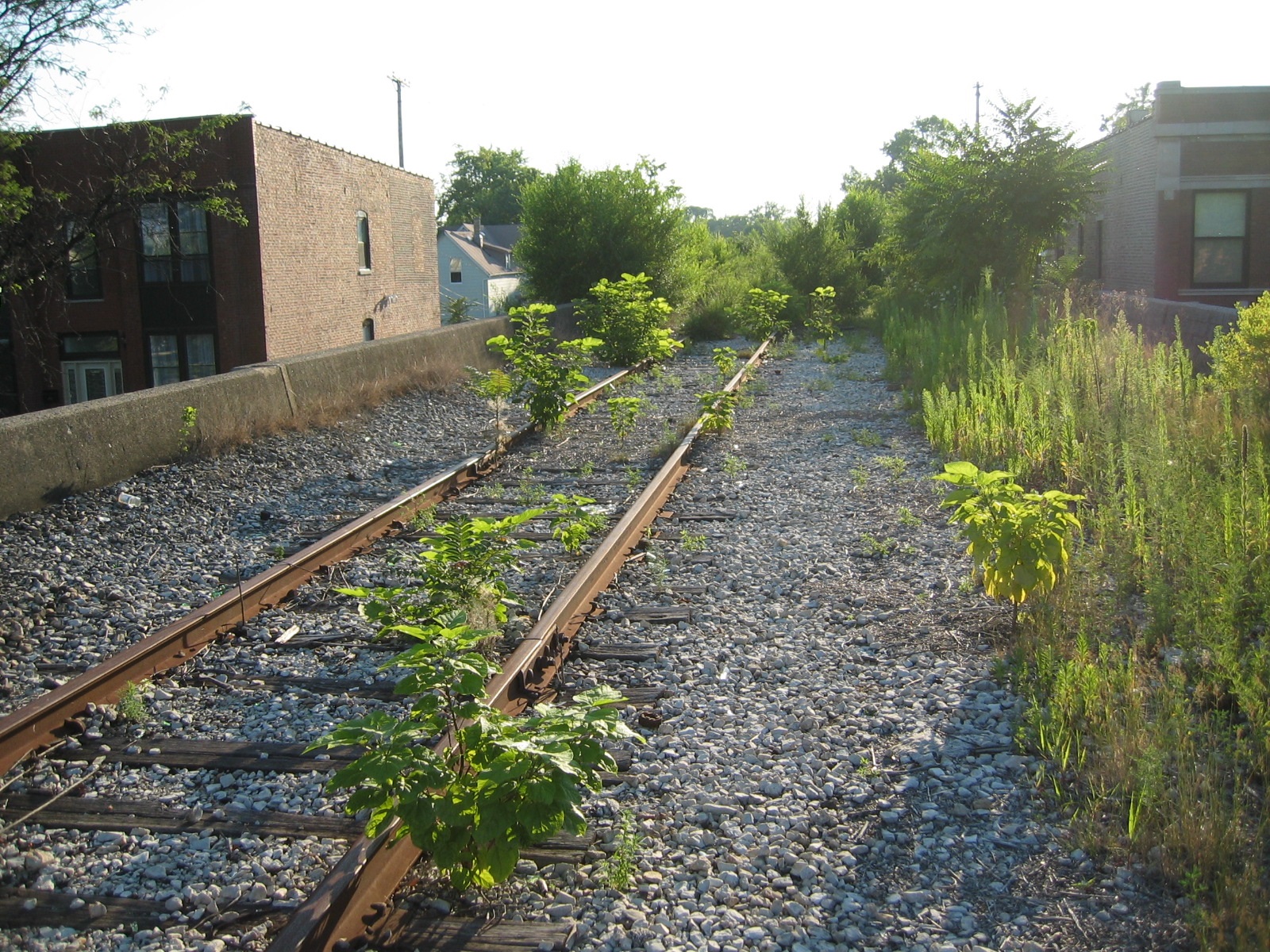
Unlike other elevated rail parks built on bridge platforms, The 606 is supported by massive concrete retaining walls filled with lake sand, silt, and gravel. The design calls attention to this original construction by lowering the path and exposing the sides of the retaining walls. Manipulating topography also facilitates access to the elevated landscape, helps slow cyclists down, accentuates views and increases ecological variety – creating a succession of shaded, wet, and enclosed environments in the low points, followed by dry, exposed highpoints with stunning views, as the line crosses major city boulevards or streets.
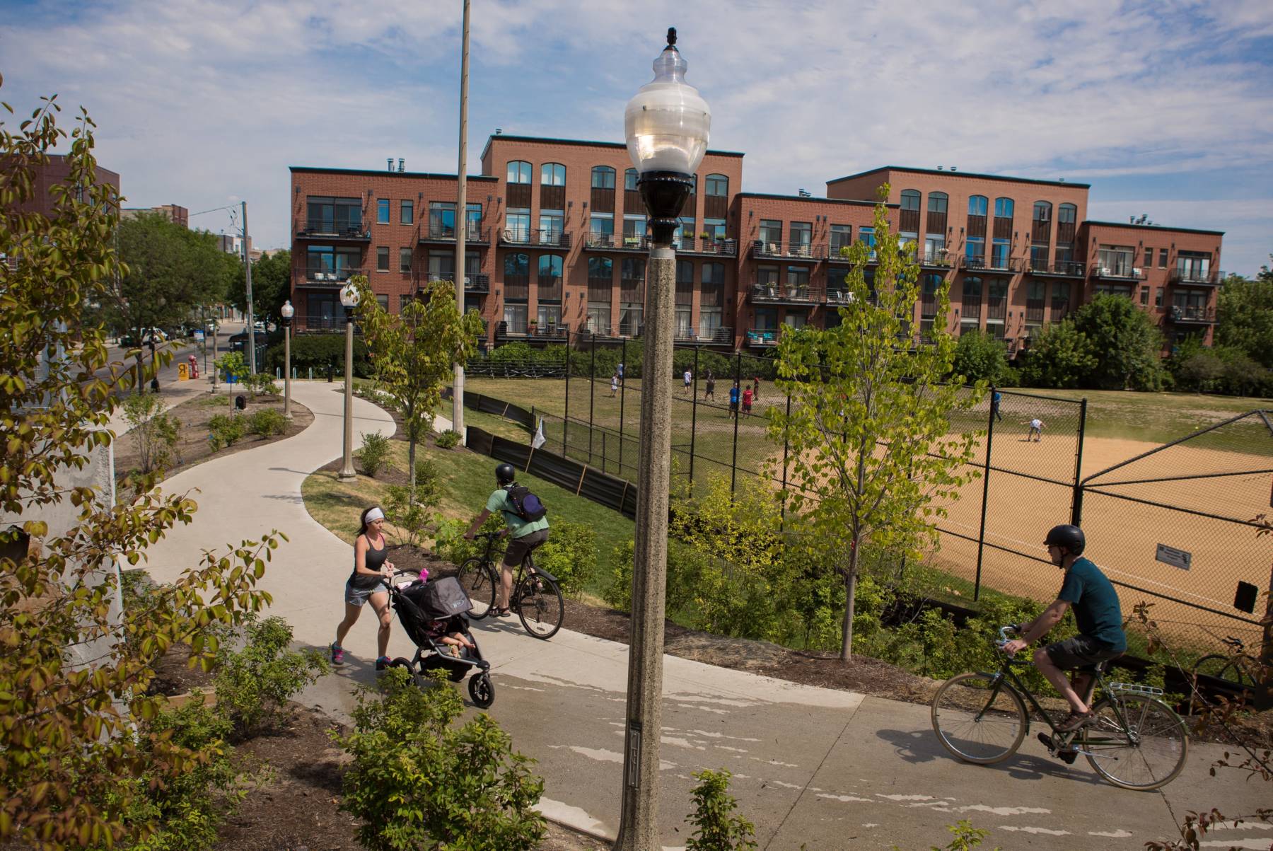
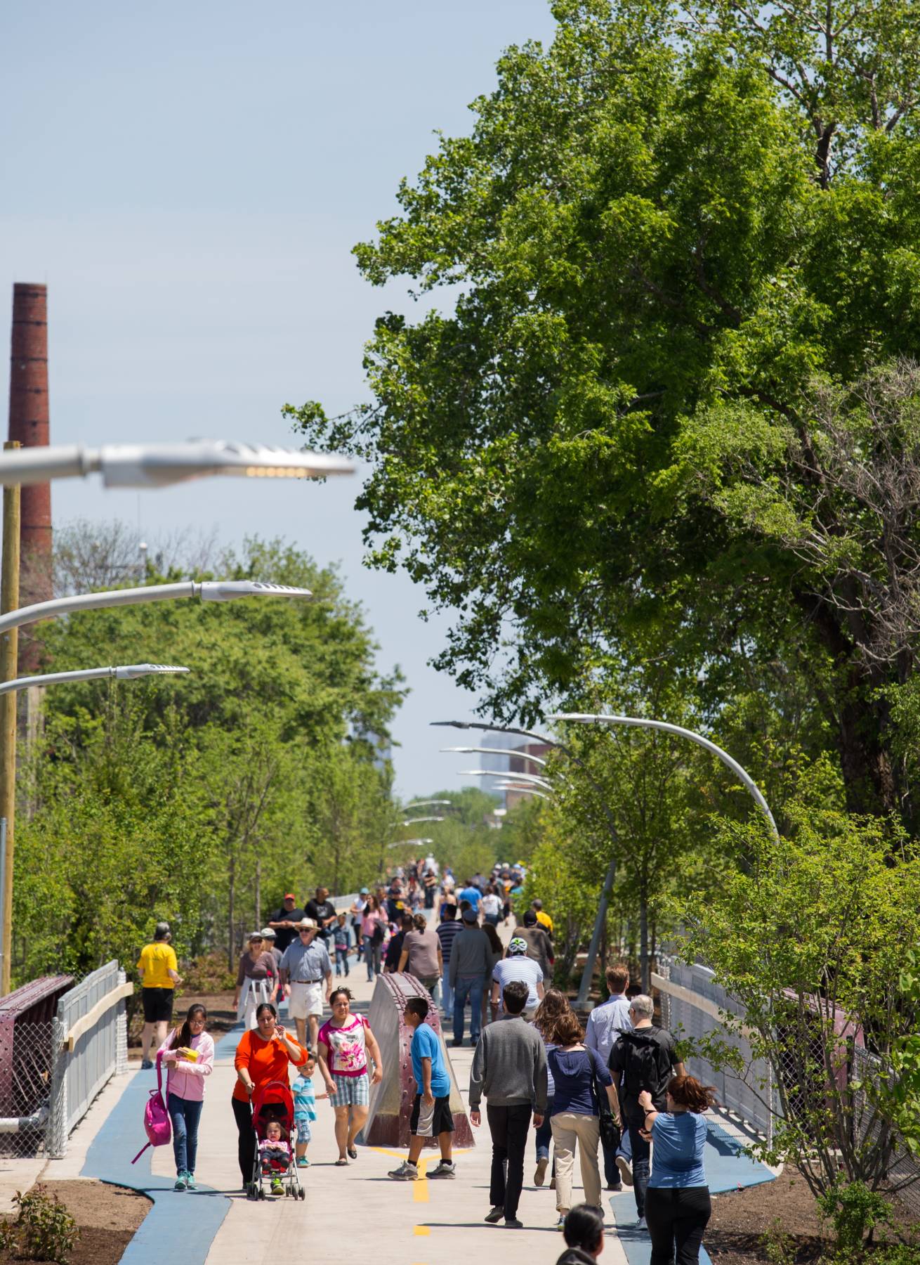
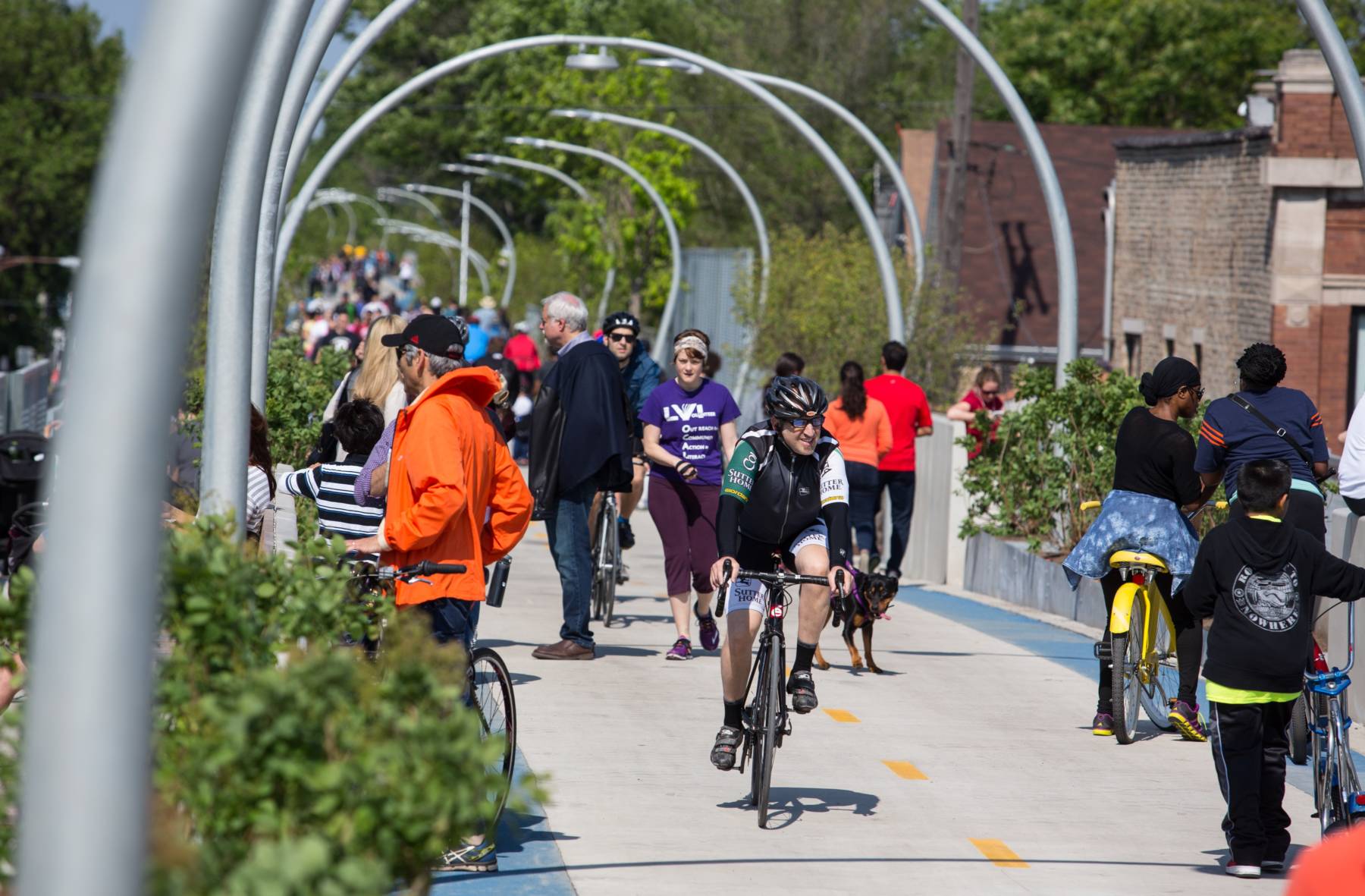
A two-lane bike path (with one lane in each direction) runs atop the entire length of The 606, flanked by rubber track jogging paths on each side. The paths take up about half of The 606’s 30-foot width, leaving the rest for landscape design, seating, low key meandering footpaths and art installations.
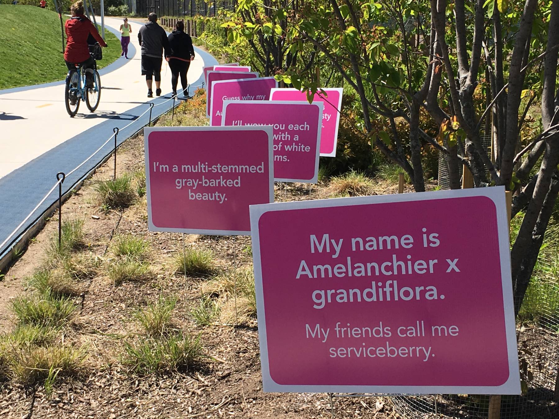
One such installation is the Environmental Sentinel, a trail-wide flowering spectacle and sculpture that highlights the unique environment created by Lake Michigan and the impacts of climate changes.
Frances Whitehead drew inspiration from Japan’s Cherry Blossom Festivals, which has been celebrated in Kyoto and the surrounding towns since the 8th century. The people of Japan began keeping records to document the bloom times of cherry trees every year in order to know when to schedule cherry blossom celebrations. Japan’s cherry blossom monitoring and record keeping is now the longest running phenological data set available that documents a changing climate.
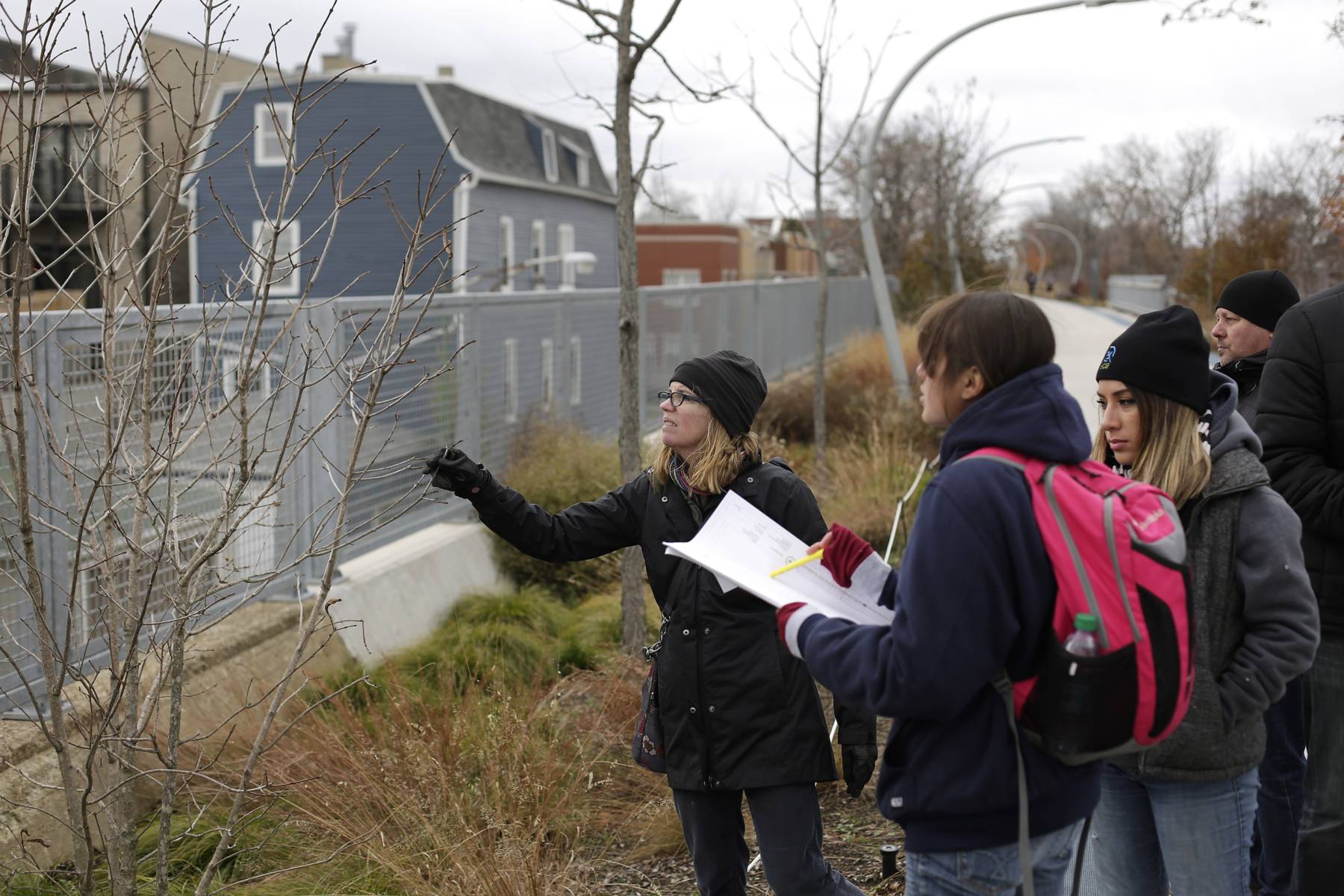
As The 606 runs perpendicular to Lake Michigan, the climate becomes slightly cooler as one gets closer to the lake. Cloned service berry trees (the Amelanchier x grandiflora ‘Autumn Brilliance’ spp., a native to the area) and the Chinese lilacs (Syringa x chinensis ‘Red Rothomagensis’ spp., a non-native plant) are dotted along the park, bursting in bloom every spring but with a delay of up to five days between the east and west end of the trail. Chinese lilacs are used by the USA National Phenological Network as the calibrating plant for comparing observations across geographies and plant families, and extend a “legacy” data set dating back to the 1970’s. This Environmental Sentinel also provides the basis for a citizen science project monitoring blooming time every year and on-going climate changes. Interpretative signage is built-in into the concrete wall and surfaces of the park to help engage trail users with the project. This includes “compass roses”, displaying the North arrow pointing East, towards the lake, as a clue to the reorientation needed to understand the impacts of the local micro-climate and of climate changes. Mile markers are also set in the jogging path near specific trees fitted with barcodes, making it easier to locate and return to any given specimen for monitoring. Further details on this, and other citizen science projects and research partnership supported by The 606 can be found here.
The wider planting scheme is akin to musical score, combining “key themes” and “variations”. Some of the key themes include the use of evergreens at entrances and the abundance of sedges throughout the park, reminiscent of the North American Midwest’s native prairie landscapes. By contrast, distinctive planting events such as the Poplar Thicket, the Sumac Tunnel, or the Echinacea Field work in concert with changes in topography, microclimate, and spatial enclosure to create variety along the length of The 606. More details about the plant palette used and the way in which it was deployed can be found here and here.
Only four years elapsed between the main design charette conducted in 2011 and the 606’s grand opening, in June 2015. This is a very short timeframe for a project of this scale. 2011 saw the election of Rahm Emanuel for his first term as the Mayor of the City of Chicago. Emmanuel identified The 606 as a priority project to be completed by the end of his term.
There were significant drawbacks from the speed at which The 606 was finalised. Since completion, the project has received criticism about its contribution to gentrification of the surrounding neighbourhoods. “When the project was being worked on initially, Chicago was just coming out of the [2008] recession and foreclosure crisis. The local low-income housing organisations were focusing on this, rather than securing affordable housing [in the area of The 606]. It wasn’t really until six months before the trail was due to open that the question was raised… People initially couldn’t imagine the transformation that was about to happen…” recalls Caroline O’Boyle. “For any project of this scale, it is essential to consider who it is for and how the people for whom it is intended are indeed going to benefit from the amenity –this might include exploring planning options for retaining affordable housing, looking at employing locals for construction and associated training… but when you move that quickly, you can’t consider carefully enough such options” she adds. The large amount of vacant land found near the park, combined with rezoning, designed to allow higher densities along what was to become an active travel transit route, further worsened the construction frenzy and land value hikes the neighbourhood experienced. One of the positive local legacies of these poorly coordinated zoning, housing and open space planning decisions was a reorganisation of the city planning department, to ensure those leading neighbourhood planning could more easily work closely with the open space team or others leading large infrastructure projects. On a national scale, it has also brought awareness on the impacts of new urban infrastructure parks on social equity, with the latter becoming a growing priority.
Another drawback from the speed at which the project had to be completed, was that TPL did not focus on building capacity among the Friends of the Bloomingdale Trail, the local volunteer-based community group whom had championed the project since 2003. The group could have been reared to endorse a prominent role in community programming and management once The 606 would open. Instead, the Friends of the Bloomingdale were asked to step back, so that TPL could more effectively lead fundraising. Today, as TPL is looking to become less involved in the ongoing community engagement and activities programme associated with The 606, this leaves a gap which the Chicago Park District doesn’t entirely have the ability to fill.
The 606’s major success lies in its popularity as a local amenity. Between 2016 and 2019, The 606 has attracted between 1.2 and 1.3 million visitors every year, primarily families, joggers, walkers and commuters. Most people who use the trail live near it. This is largely down to location and context, as The 606 runs through highly residential neighbourhoods. Design unarguably also plays an important role, as the elevated park provides amenities for commuters and recreational users alike. While accessibility is facilitated by the low height of the structure, it was further enhanced with good ground-level integration through six ‘spill over’ parks created alongside access points or through refurbishment of pre-existing open spaces.
With formerly industrial land located between the current eastern boundary of The 606 and the Chicago River being considered for residential development, opportunities for extending the linear park and trail eastwards are under discussion. The developer who owns most of the land involved has bought into the idea and incorporated it in its proposed masterplan. Serious obstacles will have to be overcome for The 606 extension to come to life, including physical ones. An expressway and a set of active rail tracks currently separate the east end of The 606 and the potential development site. Should it happen, this extension would allow The 606 to connect to the Chicago River path. Such a connection would create a continuous car free route to from Chicago’s North West side to the central business district and greatly enhance access to the riparian landscape restoration that has been the focus of the City’s open space planning work for many years.